
Kwusen is releasing a redesigned GeoKeeper app
Kwusen is excited to provide some details on the development of our completely revamped version of the community-based field monitoring and data collection app, GeoKeeper.
First developed for client use back in 2017, the original version of the app was created to make it easier for community-based monitoring teams to collect and report on field data, using devices often already in their pockets.
While improvements to the app have been made over time, we knew that a complete rebuild of the app was needed to keep up with rapidly evolving technologies and fully meet the needs of our clients. Beginning in summer 2020, Kwusen’s in-house development team started rebuilding the app to make it more user-friendly and configurable. We have redesigned GeoKeeper on a new, more adaptable framework, with client feedback front of mind during development.
Rebuild in Flutter
Kwusen Software Developer Adam Valair — who has over 15 years of experience creating maps and building applications — has been hard at work leading the in-house development of the new version of GeoKeeper.
The new app has been rebuilt from the ground-up using Flutter, an application development framework created by Google for streamlining the building of cross-platform mobile apps from a single codebase. The Flutter toolkit is optimized for building software that performs well across multiple platforms and has made it much easier for our development team to build, test, and deploy the higher-performing app to both Android and Apple devices.
Improvements
Current users of GeoKeeper who will soon be switching over to the redesigned app will notice a big difference in app usability. Our developers rethought and redesigned the data collection form layouts to be more intuitive and efficient. Priorities during development included creating smoother and faster data input steps, including simplifying the overall data collection process for field crews.
Look and feel
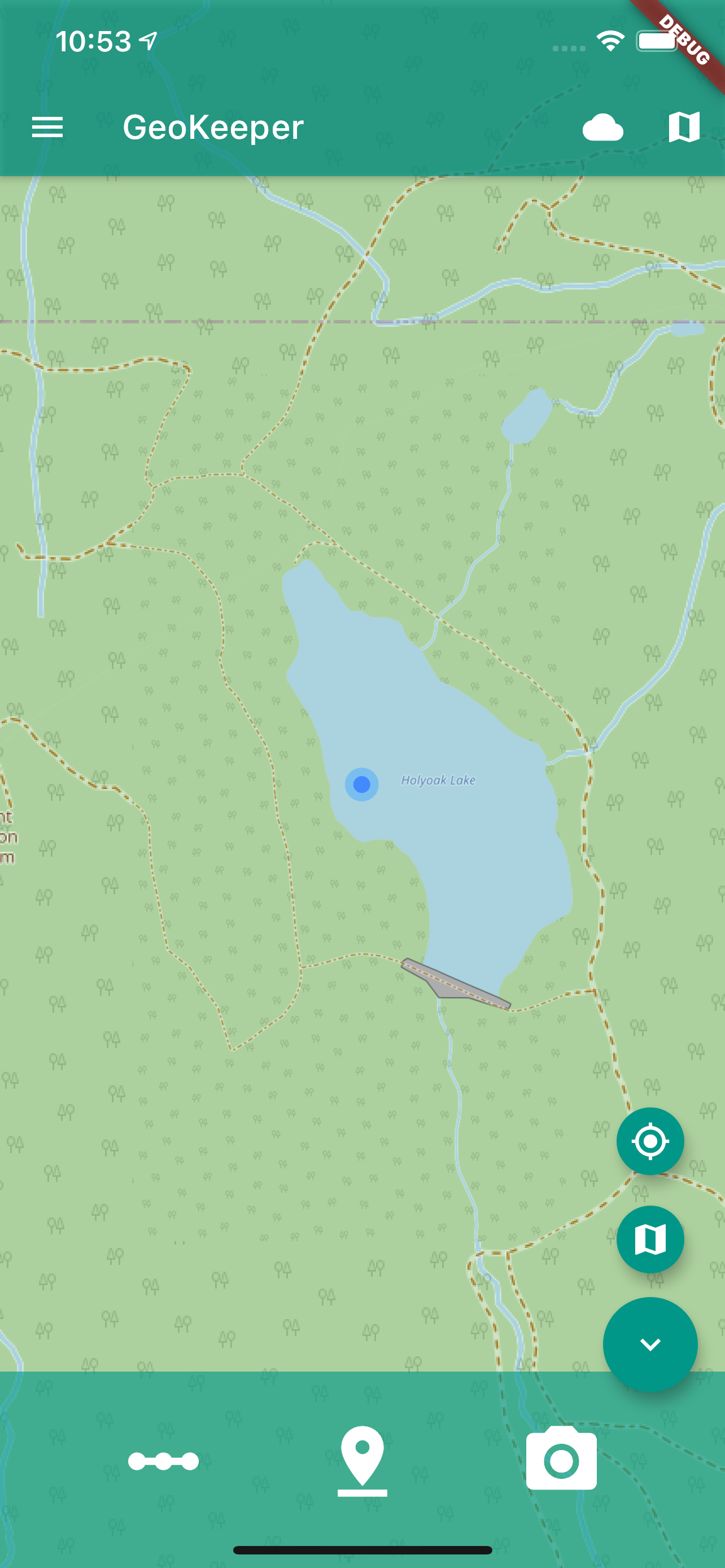
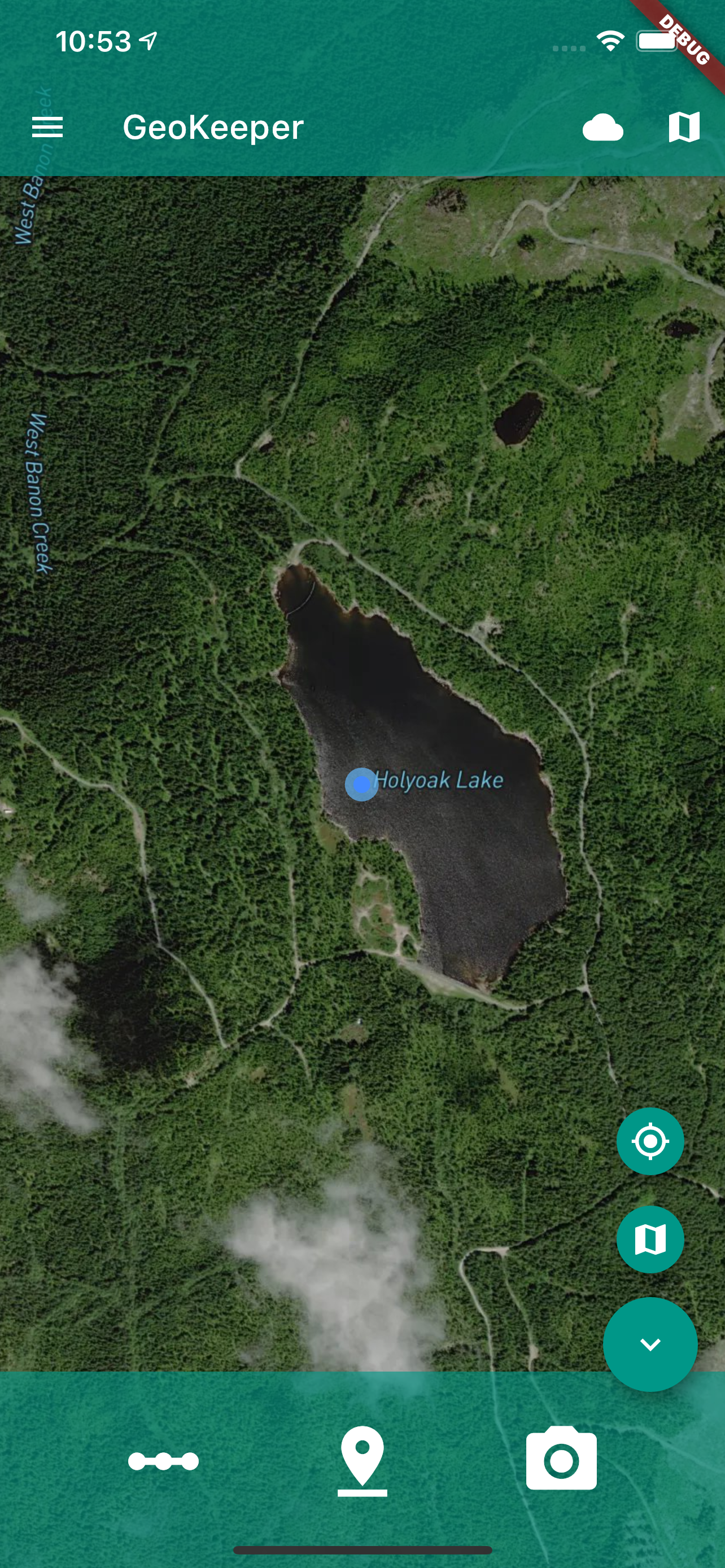
While the new GeoKeeper Interface is certainly recognizable when compared with the older app, it has a significantly newer look and feel. Using more modern design elements for app widgets and buttons, users will recognize its new icons from other mapping technologies, as they’ve been drawn from a standardized suite of icons that conform to Google’s established Material Design guidelines, used in many modern mobile and web-based applications.
Orientation indicator
We added a compass to the location indicator, which shows you which direction you are facing when in the map view.
Scrolling form page
The older app parsed out form data categories into separate ‘pages,’ with users having to navigate from one page to the next by clicking the ‘Next’ button. The new app features forms on a single ‘page’ that are easy to scroll through. (You can still use the keyboard’s ‘Next’ button if that’s your preference). With forms on a single page, you’ll be able to more easily navigate through the various fields when you are entering and revising data in a form.
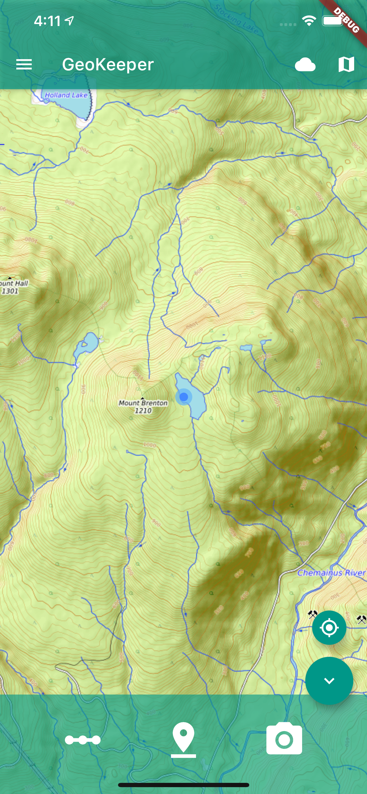
New map base layer option
The new GeoKeeper will have the option to display a topographic basemap more suitable for offline, backcountry navigation. The basemap is drawn from the volunteer-run, open-source topographic map database OpenTopoMap, which uses both OSM and SRTM (Shuttle Radar Topography Mission) data to support a global map that shows elevation and depth (hill-shaded) and other natural land variations. Displaying this map layer in the new app will allow you to better view streams, forest service roads, and contour lines on your device while collecting data in remote field environments.
Synchronization management
The redesigned GeoKeeper automatically syncs your data to the server as you create it. If you’re working in an area without network connectivity, you can sync your data with one tap when you are back in range. It is critical that the sync function works flawlessly so that the data you collect can always be retrieved. To that end we are making efforts to test different approaches and making improvements based off of feedback we’re receiving from our community testers in Fort Chipewyan. We want to ensure that sync management is simple, transparent, and well tested.
Server capabilities
The new GeoKeeper comes with a completely redesigned web-based application for program administration and exploration of data collected by GeoKeeper field crews. The web application has been rebuilt from the ground up using the same suite of technologies and design guidelines that will be in use by the new Community Knowledge Keeper application (CKK); it will offer integration with your CKK, should you have one, so all of your data is easily available.
Looking Ahead
As with all of our digital solutions, Kwusen is hyper-focused on creating our software so that they can continually be improved to better meet the needs of our clients – whether with their data collection, storage, interpretation, decision-making, or otherwise. From assessing forestry proponents’ proposed cutblocks to recording public navigation hazards for better community preparedness – our clients use GeoKeeper to support the needs and rights of their communities.
Power users of the app in Fort Chipewyan are currently testing the new GeoKeeper in the field. We are excited to start onboarding both current users of the app and new clients to our revamped GeoKeeper once testing is complete. Hopefully by spring 2021, we will be working closely with users to provide assistance in set-up, training, or app customization.
Have questions or comments about the new GeoKeeper? Please contact support@kwusen.ca. User feedback is important to us!